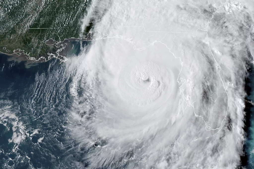

Hurricane Helene has been upgraded to a Category 4 hurricane as it hurtles toward making landfall on the Florida coast.
A Category 4 hurricane is capable of 130 mph to 156 mph winds and can cause severe damage to well-framed homes. It can also snap or uproot most trees, according to the National Weather Service.
“Update 6:20 PM EDT Thurs: Helene now an extremely dangerous Category 4 hurricane,” a social media post from the National Hurricane Center said. “A NOAA Hurricane Hunter aircraft currently investigating Helene recently found that the maximum sustained winds have increased to 130 mph (215 km/h).”
Earlier in the day, the agency said “EVERYONE along the Florida Big Bend coast” is at risk of a possible “catastrophic storm surge and damaging hurricane-force winds.”
As #Helene continues to approach the coast, please do not get overly focused on short-term wobbles in its track, “false” eye locations, or on specific computer model simulations.
EVERYONE along the Florida Big Bend coast is at risk of potentially catastrophic storm surge and… pic.twitter.com/LEFNk9UhXv
— National Hurricane Center (@NHC_Atlantic) September 26, 2024
The storm is currently on track to affect Tallahassee, Florida, directly. Tallahassee is the state capital of Florida and contains one of the state’s largest universities, Florida State University.
Helene was upgraded from a Category 2 storm to a Category 4 in a matter of just several hours on Thursday, and some authorities believe the storm could be a “historic” threat. Taylor County Sheriff Wayne Padgett warned that hundreds of residents who live in low-lying areas on the coastline could die if they don’t evacuate.
“If you’re just bound and determined to stay and not get out of harm’s way, go and take a black magic marker, write your name, your Social Security number, everything on your arm, and we can identify you. I don’t like telling people that, but it is going on,” Padgett told NBC News.
“That’s a death threat because you’re looking at, they’re calling for 18- or 20-foot storm surge,” he continued. “We’ve never had a storm surge like this in this county.”
Taylor County is just southeast of Tallahassee on the Big Bend.
“Hurricane Helene is going to make landfall this evening in the Big Bend, but dangerous conditions will be present throughout the rest of the state—even outside the forecast cone,” Gov. Ron DeSantis (R-FL) said in a post on X. “To stay safe from hazards like debris, downed power lines, and standing water, do not try to do any work in the dark tonight. State and local emergency management officials are ready to assist seniors and others in need of help clearing debris after the storm passes.”
CLICK HERE TO READ MORE FROM THE WASHINGTON EXAMINER
As of 7 p.m. Eastern, the Florida Department of Emergency Management posted on social media that the hurricane would “make landfall as a major storm soon.”
Some of those affected were previously advised to evacuate but have now been asked to shelter in place.


