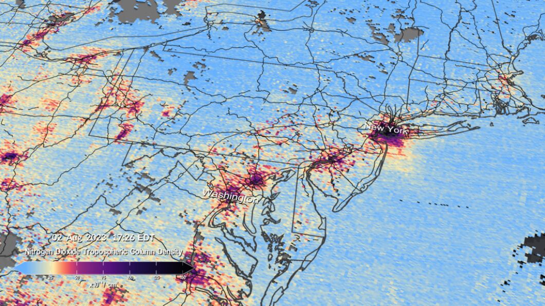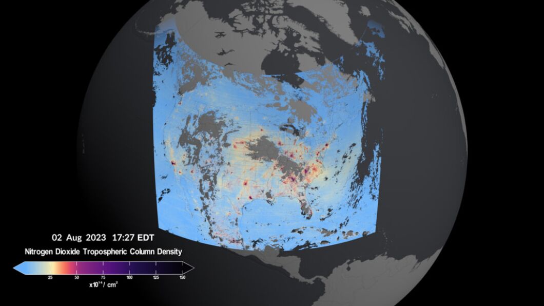
NASA unveiled its first images taken with new pollution mapping instruments.
The Tropospheric Emissions: Monitoring of Pollution, or TEMPO, launched in April from a SpaceX Falcon 9 rocket, and it collected its first measurements over North America on Aug. 2, scanning the continent every hour for six hours straight, according to NASA. The instruments work by measuring sunlight reflected and scattered off the Earth’s surface, clouds, and atmosphere.
MARK MEADOWS COURT HEARING IS FIRST BIG TEST FOR FANI WILLIS’S TRUMP RICO CASE

The map noted a high density of nitrogen oxide over major urban centers across Canada, the United States, Mexico, and the Caribbean and over highways. Dallas, Houston, New Orleans, New York, Philadelphia, and Washington, D.C., had some of the highest concentrations.
Nitrogen dioxide is primarily produced through the burning of fossil fuels, particularly for purposes of transportation, power generation, and industrial activity, but it is also produced by wildfires.
CLICK HERE FOR MORE FROM THE WASHINGTON EXAMINER

TEMPO is a collaboration between the Smithsonian Astrophysical Observatory at the Center for Astrophysics, Harvard & Smithsonian, and the NASA Langley Research Center.


